Sunday, August 25, 2019

Ireland, Day 5: Dingle all the Way


This was an epic and mind-blowing day. We were staying on northeast edge of the Dingle peninsula, way up close to Tralee. 


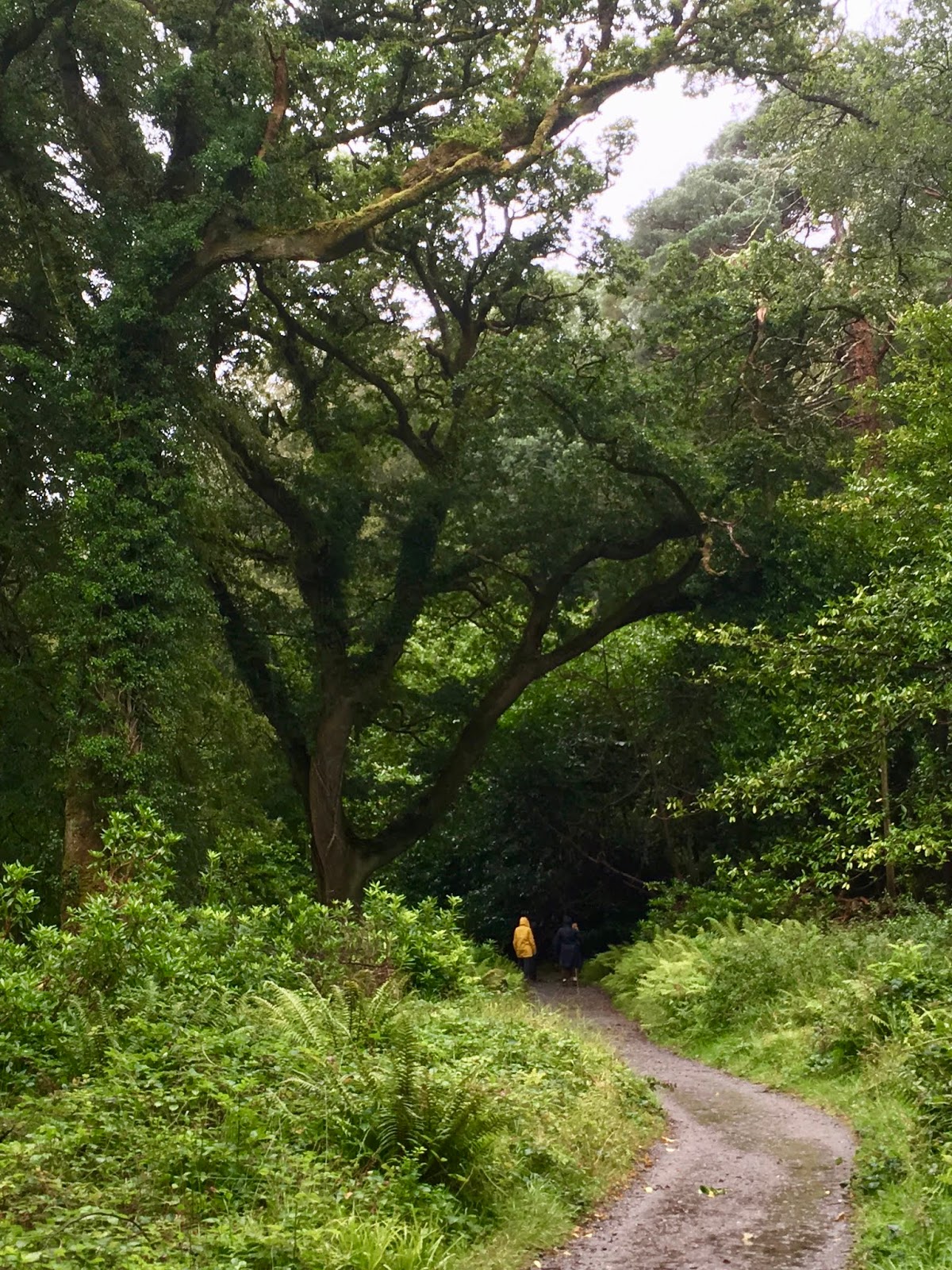
Step one: cross over the peninsula on N86. This means, along the edge of beautiful super-green valley with hills rising up 1,200 feet above us. We'd already been this way the previous day and we didn't stop for pictures today, so  here's one from then: 


We arrived at Inch Beach - wide as can be, with a view of the hills of the Kerry Peninsula just across the water. Naturally, a beach walk ensued.


And Kevin put his feet in, as he does.


From there, we headed to the town of Dingle. We'd already been, the previous day - so we just shot through and out the other side towards the Gallarus Oratory. We didn't believe it when Google Maps told us we'd arrived til we were almost past it, and saw a small parking area with a path through the fuschia.


Yes, that's fuschia. I'd previously only encountered it as a hanging basket plant on our front porch growing up, but in Ireland, it is gargantuan and ever-present, much to my delight. So we headed down the path, and found this:


Built using the traditional drystone method - no mortar - in the 7th or 8th century. 


Tight as tight can be - no rainwater can get in. One little window in the back, which faces east.


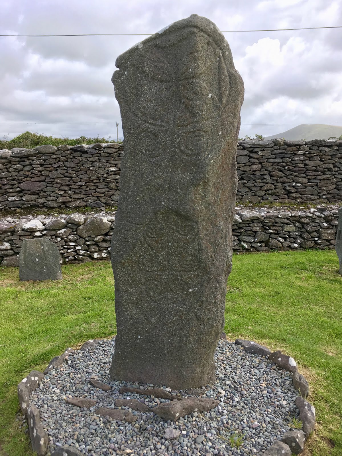
A commemorative stone. There wasn't much in the way of interpretive materials - perhaps this is a burial site.


Onwards. Note the profusion of orange awesomeness along the sides of the road...


We went a few miles away to the Reask Monastic Site. It features a burial ground and several beehive huts, built in a similar drystone fashion that's been in use in Ireland from neolithic times up through the 20th century. Thus, it's hard to date properly.  But excavations did reveal Roman amphorae (wine jugs) that date back to the 6th century. 


A view from the wall encircling the site...


The "Reask Stone". Two views - note how the carving wraps around the shape of the stone itself - especially apparent at the top:


In the picture below, that's the ocean just visible over the fuschia hedges, to the right of the headlands.


From here, we zigzagged another few miles away to Kilmakedar Church, built in the mid-12th century and displaying, architecturally, how the Irish church was trying to align itself with Rome and the rest of Europe at the time.


That's a sundial, in the foreground - a detail I missed at the time, unfortunately.

There is also an Ogham stone. Ogham is an early medieval alphabet - I'm just now reading up on it via Wikipedia and it's fascinating. This stone says  "ANM MAILE-INBIR MACI BROCANN", which is a name - "Mael Inbir son of Brocán". 


View from inside the church looking to the back of it. Note the arch details - that's one of the bits inspired by Rome.


After all this, we headed back to the town of Dingle to be able to head out in a different direction, on the drool-inducing Slea Head Drive that runs along the sea.

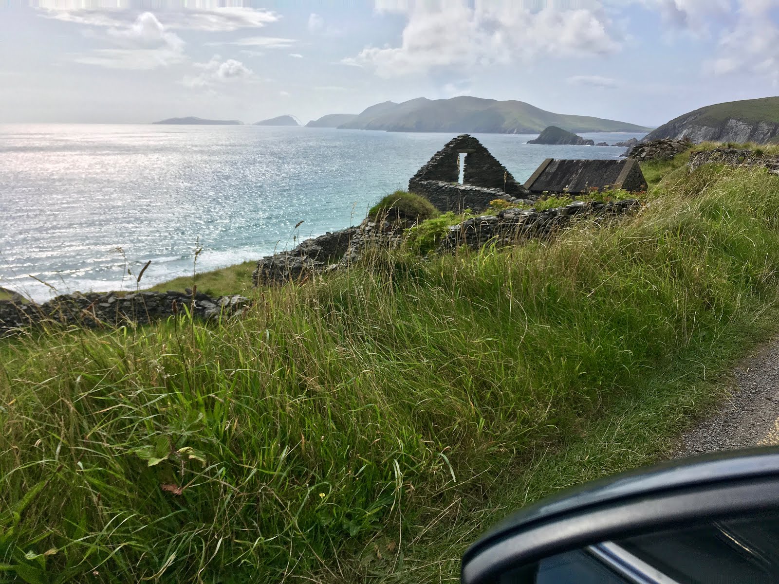
We stopped off to see some more beehive drystone huts - some of which had no roofing left, so here's me for size:


View from this site back east, toward the town of Dingle (not visible).


And now we come to the view of the Blasket Islands.


Here's the picture I was taking:


We smooch whenever possible, to the delight or annoyance of all who know us, and this seemed like a fine opportunity to indulge.


We continued toward the next headland - Coumeenoole on the map. I got a glimpse of a beehive hut and snapped this from the car window - it's that round thing topped with grass in the center of the photo.


Just around a couple of corners from here, we found a place to park along the side of the road to check out these amazing cliffs + a swimming beach. Here's the view of the beach. The pull-out where we took the previous pix of the Blaskets is visible as a little notch in the headland to the far right, below.


Looking the other way, at the cliffs. For context and scale, you may notice a couple of tiny dots on the turf at the top - those are people.


By now, our minds were officially blown. We found our way back to Dingle via a different, inland route, and took the Connor Pass back to our Airbnb. The pictures below are from the previous day when we did this same drive.


Connor Pass should be done in this direction only, we decided.

Here, watch this - enjoy the drive!


And that wasn't even the whole day. It's just the parts that got photographed.


Thursday, August 22, 2019

Ireland, Day Seven

We (meaning, of course, Kevin) drove from our Airbnb just outside Tralee over to Cobh ("Cove"), just outside Cork, today.


We're staying in an old dairy that's been converted to a sleek, modern apartment, with barn doors separating a back entrance/the bathroom, and the bedroom, from the kitchen/living room:


This place is cute enough to warrant more photos, but my feet are too tired for me to get up and move.

We went into Cobh for dinner. It used to be named Queenstown, and it's where the Titanic stopped for one last round of passengers and a mail stop before heading out to sea towards its eventual fate.

Cobh is awfully cute. We've noticed great colors every place we've been so far here, and this has been no exception:


Tomorrow we head up towards Wicklow for a final night before our Saturday flight home. At some point I'll post Days 1 - 6 in some fashion. 


Wednesday, August 21, 2019

Ireland. Day Six.


 Too many gorgeous things encountered today to not throw up a blog post.

We're in Ireland, in County Kerry. This is our 6th day. 

We're on our way to the Uragh Stone Circle outside Kinmare. It's only 3.5 km off a main road out of town, but the land is so up-and-down and the road so curvy - and narrow! - that it feels like it takes a long while to get there.

We're surrounded by big, looming hills with a lot of lichen-covered, exposed rock in a tilted, layercake formation, covered in huge tufts of grasses. Sheep abound.

We're almost there. The skies loom. 


When we finally get to the stone circle, we park next to a couple of other vehicles on the side of the road, next to a lake. Two guys next to us are getting ready to go fishing. There's a couple already headed up the hill toward the stone circle, which we can't see from here. We follow them up, pausing at the top of the hill to take in where we've just come from:


We give the couple ahead of us some space, by hiking up to a vantage point on a slight rise about 50 yards away. This gives us a chance to take in the scene. 

There's another lake, not visible from the parking area. Panning from from east to west, both lakes are visible below. So's the stone circle: look for bright dot, at center of of picture - it's the woman's raincoat:


Here's a close-up of that view - notice the waterfall...


The setting was more dramatic than even these pictures can show - huge, rugged hills, and a great wind with a light rain starting up.

Soon, the couple who'd gotten there first left, and we walked down the hillock to the circle.

I walked all the way around it first. Here's looking south/southeast...


 It's quite small, maybe a couple meters wide. One big stone, five smaller ones. 

A bit more south-ish...


We hung out for a while, mesmerized by the ruggedness of the landscape.


Finally, we left, and made our way in a gusting rain through Killarney National Park. 

It was so socked in with bad weather that we missed seeing these apparently legendary and epic views.  "Ladies View" is so striking that a local supermarket in neighboring Killarney has it as a mural in its windows. 

When you can't see much of anything like that, you're free to pay attention to the rest of what's happening, like the most incredible collection of trees I've seen in a long while.

What captured me the most were the oaks. 


At one point, getting progressively soaked, we hiked half a kilometer to a waterfall. The closer we got to it, the more spectacular they got. I could swear they were sentient. I've read a lot about trees lately (most recently, Hope Jahrens' "Lab Girl") and it just seemed impossible that these trees would not be aware of one another via all the various means trees communicate - intertwined roots, chemical signaling, sprinkle in some magic for good measure: basically, my mind was blown. 

We'll start with this gigantic oak - note the two people for scale.


Then there's this one:


Gaaaahhhhh....

And the moss! And the ivy: At the foot of another one:


So much moss - this tree was this mossy, all the way up (hello, Kevin!):


This next one, I wonder what happened to make it take this shape. No real idea. It does sort of look like more than one tree, smushed together.


It was seeing the following three together, that got me to thinking of the degree to which they might be aware of one another. 


The only way to begin to fit the whole thing in is to go sideways; thank you, Kevin, for showing the scale...


And the shapes! Every time I saw a new one, I'd feel electricity coursing through me. I was so amazed at everything we were seeing.


Don't worry, this next one appears to be doing just fine, horizontally:


Whew. That wasn't even all the day. But it's all I'm going to post about for now.